Click on Google Logo above to go to full Google map for Directions, Street View etc
Undiscovered Scotland wigtown-booktown.co.uk wikipedia D&G Online Wigtown is a small town standing on a hill overlooking the Bladnoch estuary. Bladnoch is a tiny village with a couple of streets, an Inn and the Distillery.The River of the same name and its main tributary the Tarf Water are the main rivers draining the area between the Luce and the Cree, but there are no settlements of any size north of the A76. Not too much evidence of ancient occupation either apart from Loch Maberry Castle - Prehistoric crannog "with post-prehistoric use" according to Historic Scotland, which may have been linked to the mainland by causeways. Port WIlliam is the only port on the west of The Machars peninsula - the Kilantrae burn penetrating the low cliffs of the raised beach along that coast. It was also well known for smuggling. Whithorn was the site of the most southerly railway station in Scotland, as the terminus of the former Wigtownshire Branch, until it was finally closed in 1964. Nothing much remains. The Isle of Whithorn has not actually been an island since 1790 when a causeway was built to join in to the mainland. The causeway has since been widened and had houses and shops built on it. The Machars peninsula was used for locations in the 1973 film The Wicker Man. A Wickerman music festival was held at East Kirkcarswell, 6 miles from Kirkcudbright from 2001 to 2015. Undiscovered Scotland Area Map Old Maps: Isle of Whithorn - 1753 as an island 1850 with causeway, modern map shows accretion to causeway. Wigtown - 1753 1850 1946 showing railway, and station placement - Wigtown is on a steep hill so the railway avoided it, with station placed nearer the harbour. 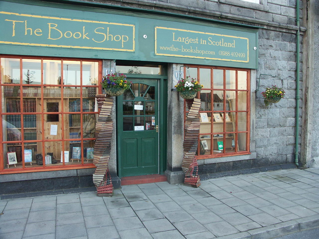
Wigtown & WhiskyBladnoch Distillery is in the small village of Bladnoch about a mile south of Wigtown. Nearest specialist shops: AD Rattray Whisky Experience, Kirkoswald (44 miles) TB Watson, Dumfries (51 miles) and Robbie's Drams, Ayr (50 miles)
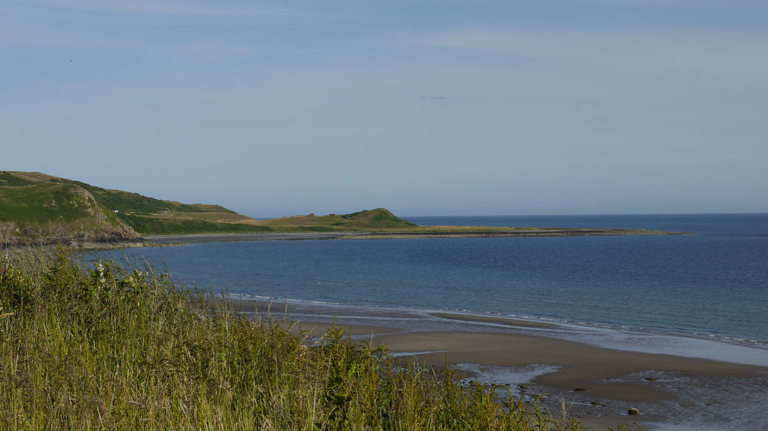
NearbyGarlieston (Gaelic "garbh" or "gearr lios" - "rough" or "short garden") became established as a port by 1790 and gained importance as Wigtown's Harbour silted up. In WWII the Mulberry harbour structures used in the D-Day landings were trialled here. Close to Garlieston, is the ruin of Cruggleton Castle originally built by the Lords of Galloway; then held by the Balliol and Comyn families before being captured by Robert the Bruce's forces. Sacked and rebuilt a few times, the Elizabethan spy of 1563 reported a functioning castle; it was finally abandoned in the 17th century.
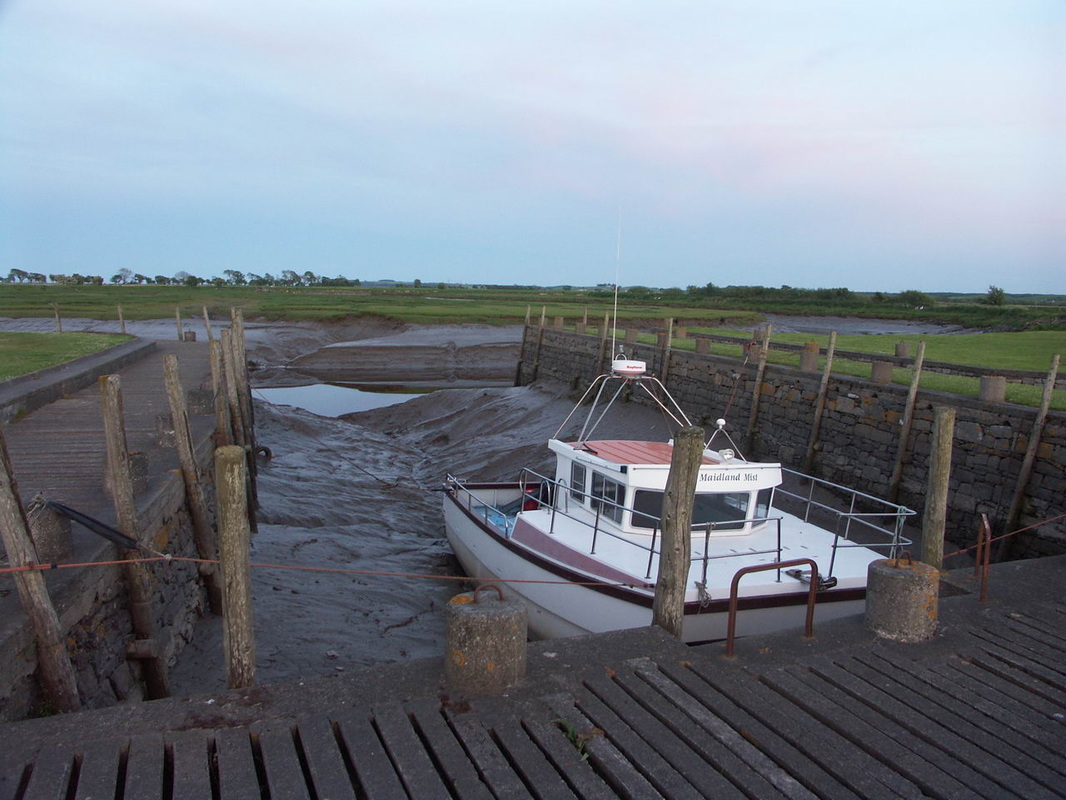
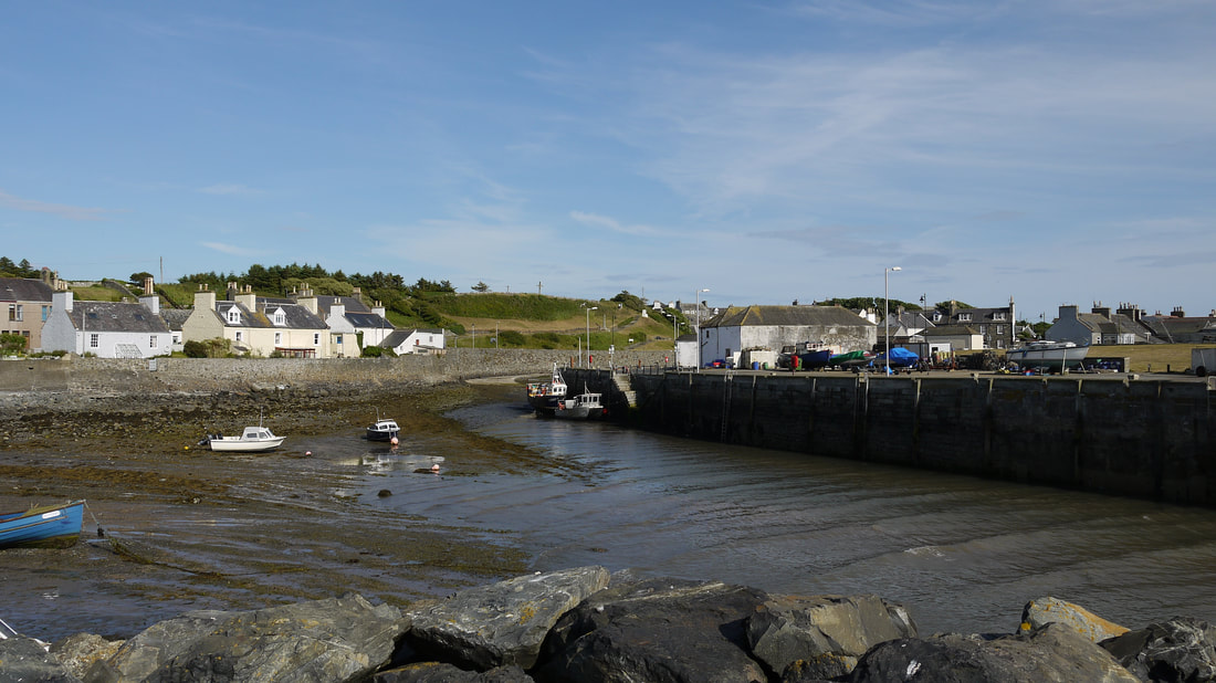
Cornmill B&B Garlieston 01988 600601/07842 906629/07927 178292 The Harbour Inn Garlieston 01988 600685 The Pheasant Sorbie 01988 850270 Killantrae (Gaelic "kil an traigh" - church on the beach") was rebuilt by SIr WIlliam Maxwell in 1776 and renamed Port WIlliam, it was a commercial port until the early 20th century. Improvements have been made to the harbour, which is now used for fishing and leisure, as recently as 1980. The Maxwells were lairds of nearby Monreith House just to the east, where recent excavations of the drained Black Loch of Myrton have revealed a well preserved early Iron Age settlement. Monreith House was the 18th century replacement for the earlier Maxwell residence Myrton Castle, whose ruins are a few hundred yards north of the House. The Estate has seen better days, and the House has suffered neglect, and has had to be rented out for holiday lets, though I'm not sure that's available at present. The Clansman 11 The Square 01988 700344 Monreith Arms Hotel 3 The Square 01988 700232 Hawthorn House B&B Second Sands 01988 700989 See also portwilliam.com Monreith is two miles south of Port William. A memorial to Gavin Maxwell in the form of a statue of an otter can be found on the road to St Medan Golf Club a few miles south of Port William. The author of Ring of Bright Water was born in Elrig north of Port William and was an heir to the Monreith House estate. Cairndoon Byre B&B A747 Cairndoon 01988 500895 Galloway Astronomy Centre Craiglemine Cottage, Glasserton 01988 500594 Whithorn (believed to come from a translation from Latin of "Candida Casa" to Old English "hwit erne" - "white house" referring to the clay house built by St Ninian). From around 390 Whithorn's association with St Ninian who built the first church in (modern day) Scotland made Whithorn a place of importance - and from Whithorn, Christianity was spread through what is now Scotland - there are shrines to him around the country, but Ninian was buried in his church at Whthorn, which has become the main shrine. By 1177 the Cathedral and a Priory of the Premonstratensian Order of White Canons had been built. St Ninian's shrine is a major destination for pilgrims at this time and for another 400 years. But after the reformation, the monasteries in Scotland were doomed, some were plundered but many left to rot - this appears to have been the fate of Whithorn. A new parish church was built in 1822, with some restoration of the what remained of the older structures undertaken later in the 19th century. Castlewigg Lodge A746 north of Whithorn 01988 500294/07855 064060 Chapel Outon Farmhouse B&B Off A746 north of Whithorn 01988 500136 Central Café 17 George Street 01988 500210 The Calcutta Inn 35 St John Street 01988 500455 See also Welcome to Whithorn The Isle of Whithorn was the port for Whithorn and had some success particularly for trading with Ireland and the Isle of Man; as well as fishing and ship building in the 1800s. Now the harbour is mainly for leisure, though some fishing remains. St Ninian's Chapel is thought to have been built for pilgrims travelling to Whithorn Priory. Isle of Whithorn Castle is actually a tower house built in 1674. Steampacket Inn Harbour Row 01988 500334 RA See also - isleofwhithorn.com Ancient HstoryThere is a considerable amount of evidence of pre-historical occupation in the area. The map included on the St Ninian's Chapel information board (below) indicates a number of stone circles etc in the area. Torhouse is covered below, Ciarnholy on the Newton Stewart page.
Torhousekie, as it is also known, is a stone circle of 19 stones next to the B733 road from Wigtown to Kirkcowan, about 3 miles from Wigtown. The 3 central stone's have been referred to as King Galdus's (a mythical Scottish king)Tomb. There is also a 3 stone row, Torhousekie East, on the opposite side of the road, which is thought to have been the remains of another circle. There are many other stones and cairns in the immediate vicinity - see links from Megalith Portal site. There are further neolithic and iron age remains near Port William - notably at Drumtroddan Standing Stones and the nearby Cup and Ring marked stones; and Barsalloch Fort. Rispain Camp, another Iron Age site is just to the west of Whithorn. 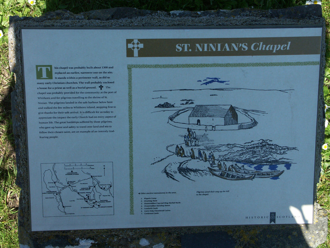
St Ninian's Chapel, Isle of Whithorn
|
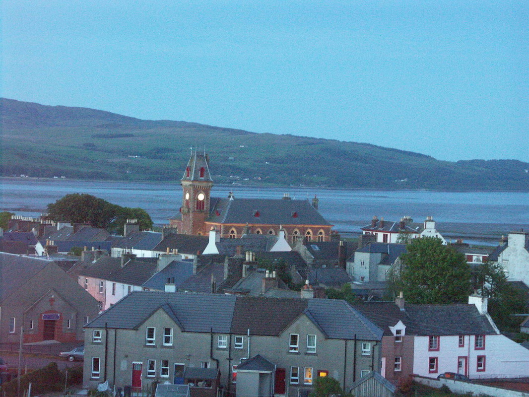
Wigtown is now a small town at the Machars peninsula, but it was once the main settlement in the West of Galloway, and hence came to be the county town of Wigtownshire. It became a Royal Burgh before 1300. It was a port and had a ferry across the Cree to Creetown from about 1400 until the 19th century. The silt brought into the area by the Rivers Cree and Bladnoch, and the shifting path of the latter caused many problems for Wigtown as a port over the years, and though the harbour was restored in the 1980s, it is again heavily silted.
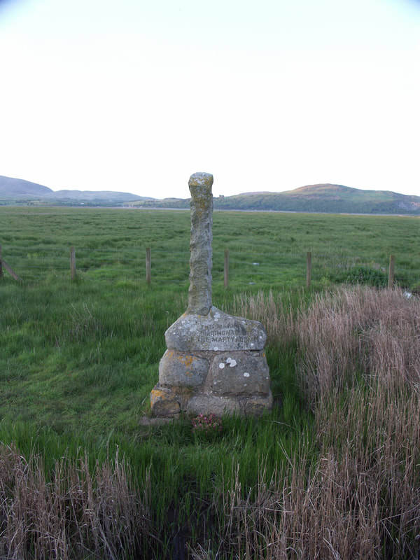
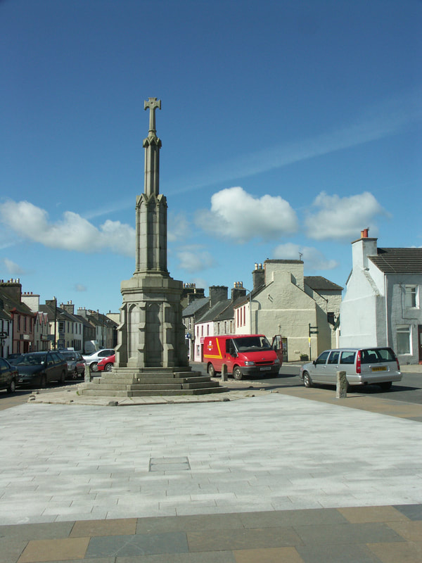
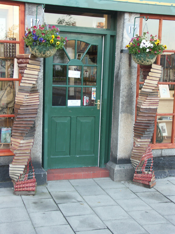
Wigtown briefly had a castle down towards the harbour, with the River Bladnoch flowing past it in those days, it was probably built in the 12th century, captured by Robert de Brus (Robert the Bruce's grandfather) in 1286; by Edward I of England in 1291; by William Wallace in 1297; and believed to have been destroyed in 1315 to prevent any possibility of further occupation by the English. Nothing much to see now. The Wigtown Martyrs are commemorated by three memorials in and around Wigtown. The circumstances leading to their deaths were the attempts by King Charles II and James VII(II) to suppress the Covenanters. From 1684 all persons taking public office were required to abjure the Covenant - with death the penalty for refusal, which lead to the Killing Time and the murder of many who refused. SW Scotland was a focal point for Covenanters and for governmental reprisals. 3 men were hanged and 2 women drowned on 11 May 1685. The largest monument is on Windy Hill above the town, and the most famous is probably the Martyr's stake where the women were drowned in symbolic remembrance of the stakes they were tied to as the tide rose. The graves of the five are in Wigtown's old kirkyard surrounded by iron railings. The two women, Margaret Wilson, and Margaret McLachlan, were actually reprieved, but Robert Grierson - the Cruel Lag - chose to ignore the reprieve. Wigtown has two mercat crosses - the old cross was removed while the square was constructed, and a new larger cross erected in 1816 (though Canmore suggests it dates to 1738); the older cross being re-erected first to the west and then to the east of the new cross. The current county buildings appear to be at least a thrid generation of municipal buildings following the original tollbooth. The Wigtownshire Railway went not only to Wigtown but as far as Whithorn, branching from the Portpatrick Railway at Newton Stewart. It had a total of 10 stations, including the Branch to Garlieston; was opened as far as Garlieston in 1875 and through to Whithorn in 1877. The line didn't even survive until the Beeching Axe - it was closed in 1950. Wigtown calls itself Booktown on account of the number of second-hand bookshops in town. The book trade was initiated as a result of the closure of the Distillery and the Creamery which were important employers. The Distillery has of course since re-opened. Arriving & DepartingOpen Cycle Map Bing Map
Wigtown is a few miles from National Cycle Route 7 which passes through Newton Stewart, National Cycle Route 73 is being developed, and will go from Newton Stewart to Stranraer and Cairnryan via Wigtown. Local cycle routes. Nearest stations - Barrhill (BRL) (25 miles) (Live Train Times) or Stranraer (STR) (25 miles) (Live Train Times) However, bikes are carried on Stagecoach bus 500 from Dumfries to Stranraer, which passes through Newton Stewart (6 miles) SleepingBrora Lodge B&B Station Road 01988 402577
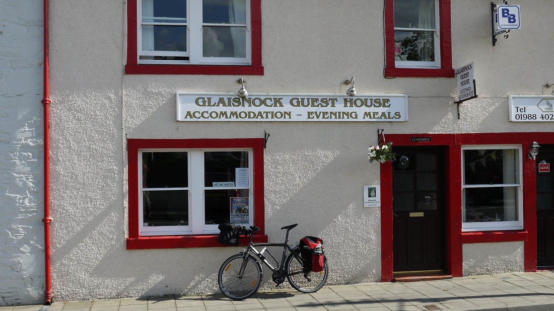
Craft Hotel 30 South Main Street 01988 403236 Galloway Inn 24 South Main Street 019884 02431 Glaisnock GH 20 South Main Street 01988 402249 I've stayed at Glaisnock on both my visits to Wigtown, though it had changed hands in between my visits - and it appears to have changed hands again. Being Wigtown, it's a bookshop too. Hillcrest House Maidland Place, Station Road 01988 402018 Wigtown House Hotel 19 Bank Street 01988 402040/402391 Bladnoch Inn Bladnoch 01988 402200 For other accommodation - see D&G Online visitsouthernscotland.co.uk/

EatingBayview Bistro 19 Bank Street 01988 402040/402391
Cobwebs Café 31 South Main Street 01988 402097 Craft Restaurant 30 South Main Street 01988 403236 Galloway Inn 24 South Main Street 01988 402431 Glaisnock GH 20 South Main Street 01988 402249 Bladnoch Inn Bladnoch 01988 402200 DrinkingCraft Restaurant 30 South Main Street 01988 403236
Galloway Inn 24 South Main Street 019884 02431 Bladnoch Inn Bladnoch 01988 402200
CyclingNearest Cycle shops - Newton Stewart (7 miles)
Kirkcowan Cycles Old Red Cross Hall ,Victoria Lane 01671 401529 Palnure: (9.5 miles) the break pad Kirroughtree Visitors Centre, Forest Drive 01671 401303
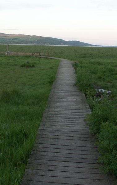
Wigtown Marshes
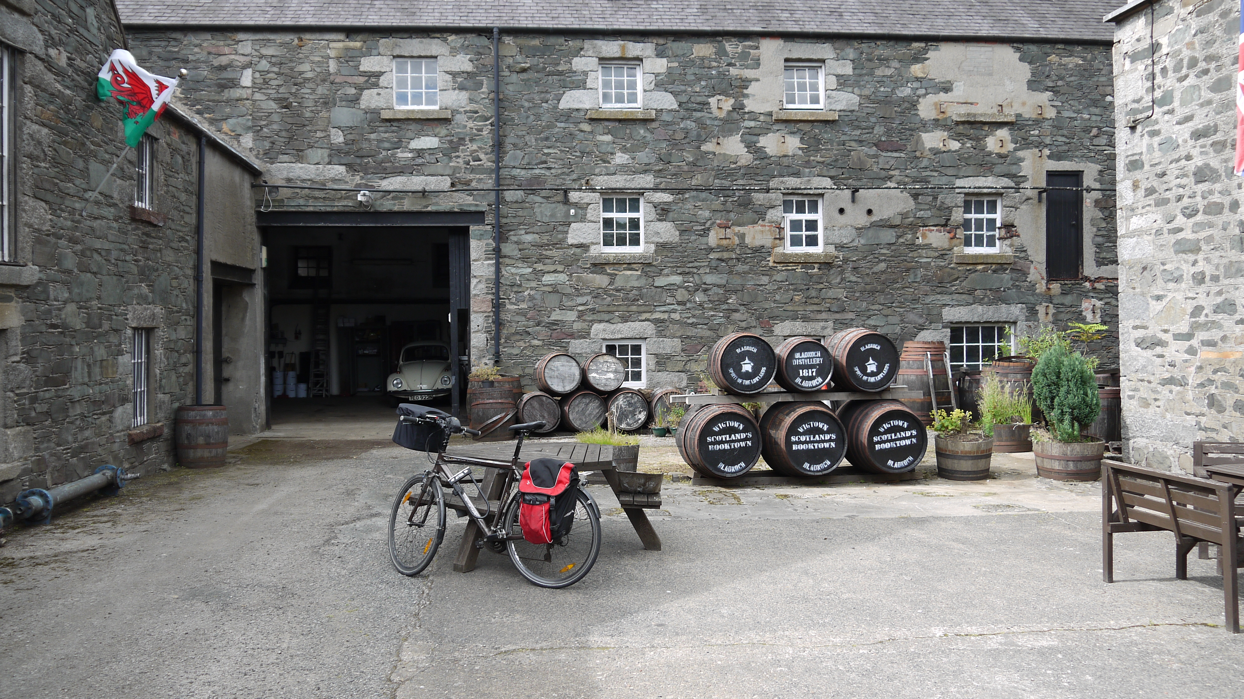
Bladnoch Distillery
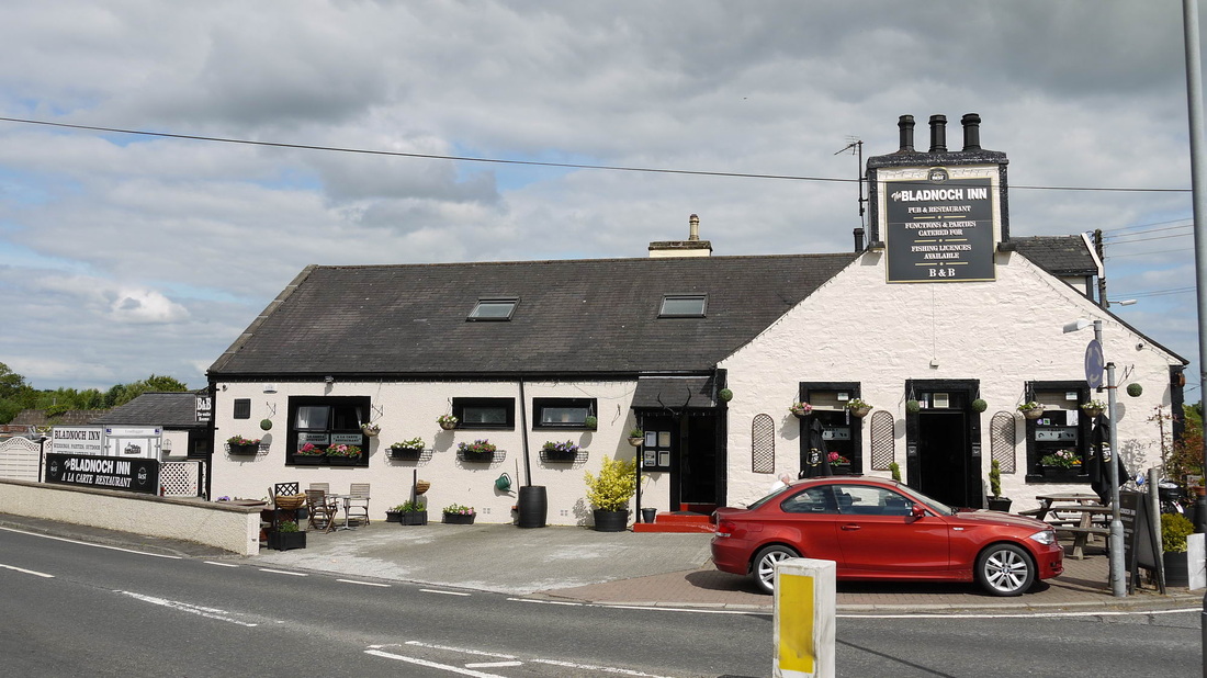
Bladnoch Inn
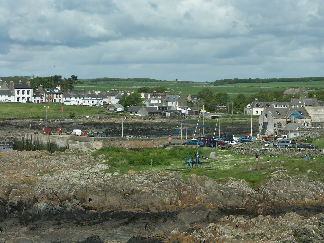
Port William
Monreith
|


The Harbour Inn, Garlieston
|

Garlieston Mill
|
Isle of Whithorn
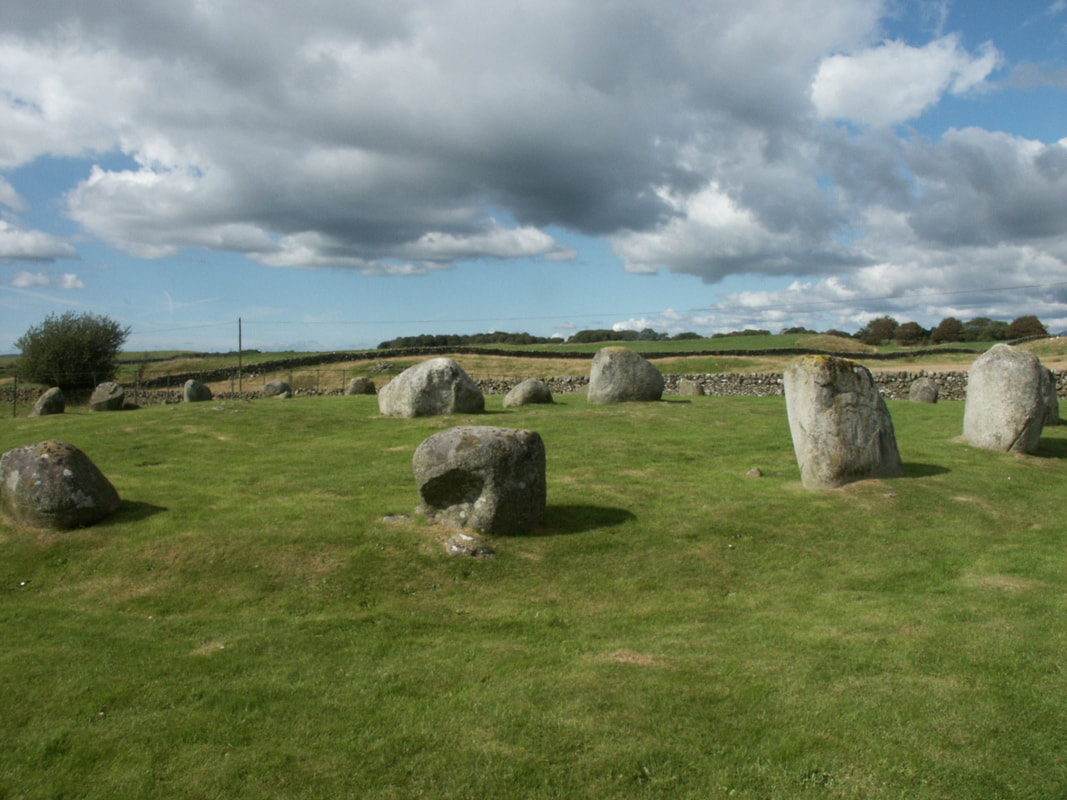
Torhousekie Stone Circle
|
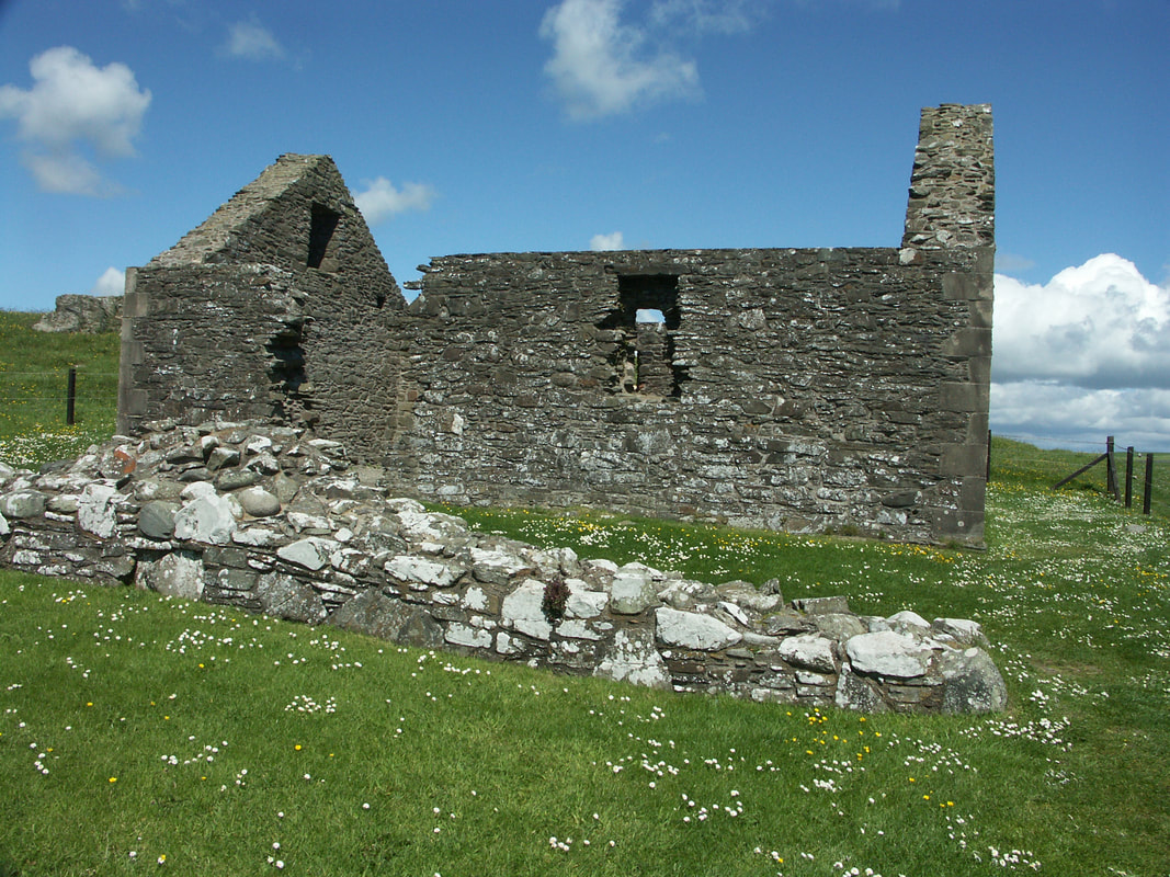
St Ninian's Chapel, Isle of Whithorn
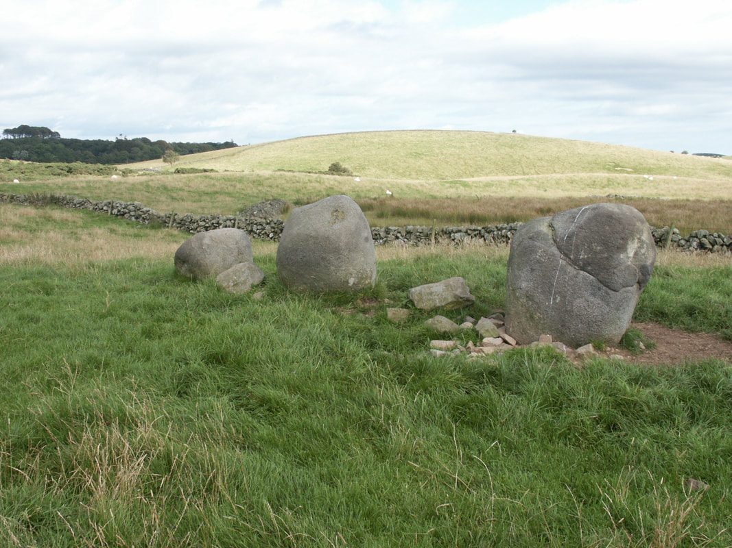
Torhousekie East
|
Photos on this page were taken by me. Click on photo to enlarge. Full size versions and my other pictures of Wigtown and Bladnoch are available at: https://www.flickr.com/photos/martynjenkins/sets/72157628774223477
Garlieston: https://www.flickr.com/photos/martynjenkins/sets/72157663041090298
Isle of Whithorn: https://www.flickr.com/photos/martynjenkins/sets/72157628775816343
Port William: https://www.flickr.com/photos/martynjenkins/sets/72157628775843215
Torhousekie Stone Circle: https://www.flickr.com/photos/martynjenkins/sets/72157628768248219
