Nearby: Crocketford; Crossmichael; Parton; New Galloway; St John's Town of Dalry, Carsphairn
Undiscovered Scotland Wikipedia CastleDouglas.com
A settlement on the west side of Carlingwark Loch called Carlingwark; and one at the north end called Causewayend are shown on the Roy Lowlands 1752 map, with the Carlingwark Burn running from the Loch to the River Dee, close to Threave Castle about 1.5 miles from the town. The castle was built by the splendidly named Archibald the Grim "He was callit Archibald Grym be the Englishmen becaus of his terrible countenance in wierfare {warfare}". By 1832 the map shows that the Burn has become a Canal, now known as Carlingwark Lane, this had been done to help transport marl dredged from the loch to New Galloway via the RIver Dee. Castle Douglas had been built by then for processing cotton - it was a planned village, the main street, King St is flanked by Queen St and Cotton St. The River Dee is unusual for a major river in these parts as it flows through a number of Lochs for part of its course. It rises in Loch Dee in the Galloway Forest Park, then flows to Clatteringshaws Loch (a Reservoir constructed 1932-1938) and Stroan Loch (where it is crossed by the Stroan Viaduct of the former Portpatrick Railway - which is part of a walking route - looks like it should also be OK for cycling) before coming to the much more substantial Loch Ken. Up to this point it is also known as the Black Water of Dee. Loch Ken is now a reservoir, though the barrage (built 1931-1934) at Glenlochar raised its level by less than 2 metres and didn't substantially increase its size - it is a regulatory reservoir for the Galloway hydro-electric power scheme. Loch Ken extends almost as far north as New Galloway, a total length of some 9 miles. It is crossed near Parton by the Loch Ken Viaduct, built for the Portpatrick Railway, but now sadly in such a state of disrepair that it cannot be used even by pedestrians and cyclists. Loch Ken is a Site of Special Scientific Interest; a Special Protection Area; and a Ramsar Site (a wetland of international importance). The Water of Ken discharges into the north of Loch Ken just south of New Galloway, further north its valley is known as The Glenkens, in which it flows through Kendoon, Carsfad and Earlstoun lochs which were both dammed in connection with the hydro-electric scheme. A comparison of the maps from the 1920s and 1950s shows the effect that the scheme had on the landscape. Video of the Water of Ken flowing through a temporarily drained Earlstoun Loch in 2015. Carsphairn is a small village at the junction of the A713 road up the Glenkens from St John's Town of Dalry, and the B729 from Moniave; 5 miles from the border with East Ayrshire - the pass rises to around 300m on its way to Dalmellington. Carsphairn sits under the Craig of Knockgray, a foothill of Cairnsmore of Carsphairn - the highest of the Carsphairn and Scaur Hills, a large area of sparsely populated high moorland between the upper Glenkens and Nithsdale. The hills on the other side of the pass, the Rhinns of Kells rise even higher to Corserine at 814m and tower above Loch Dee and Clatteringshaws Loch and a ridge called the Rig of the Jarkness. Carsphairn is also near where Carsphairn Lane and Garryhorn Burn meet the Water of Deugh, which goes on to meet the Water of Ken at Kendoon Loch (a reservoir built as part of the Galloway hydro-electric power scheme. Castle Douglas & WhiskyNothing in Castle Douglas. Whisky Shop in Dumfries - TB Watson (aka Drambusters) (16 miles).
Nearest distilleries - Annandale (37 miles); Bladnoch (39 miles) Undistilled Whisky: Sulwath Brewery is highly recommended by WhiskyCyclist - their beers available in at the Brewery Tap in Castle Douglas and surrounding area, and other parts of the country. 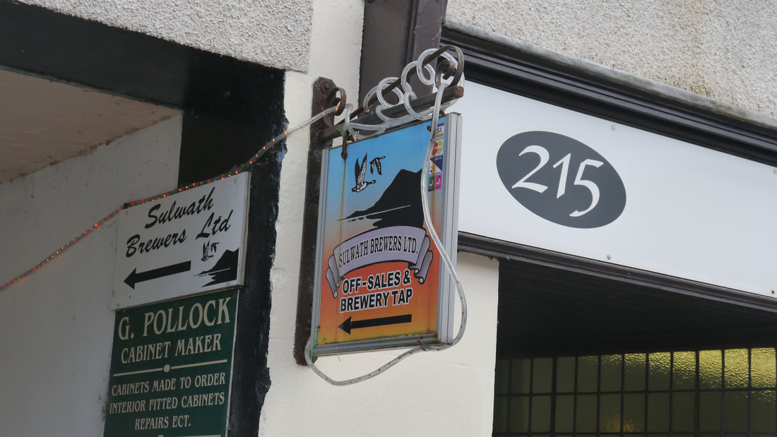
NearbyCrocketford also known as Ninemile Bar - nine miles from Dumfries, nine miles from Castle Douglas is at the eastern junction of the A75 and A712 (they take very different routes across Dumfries and Galloway before meeting up again just outside Newton Stewart). The village was founded by followers of a religious fanatic Elspeth Buchan, who believed herself to be the woman referred to in Revelation 12 - and immortal - the sect collapsed soon after she died in 1791.
East Brae Cottage A75 01556 690296/07742 525451 Galloway Arms A75 01556 690248 MW Inn on the Loch Auchenreach Loch 01556 690281 The Grapes Hotel A75 (Springholm) 01556 650566 (Ignore map on Facebook page) Isla Cottage B&B A75 (Springholm) 01556 650275 Crossmichael is a small village on Loch Ken, the distinctive round tower and steeple of the church is believed to pre-date the rest of the building which is from 1751, by about 140 years. The name comes either simply from the cross of St Michael, patron saint of the church; or it once had a cross around which a Michaelmas Fair was held. It now has a marina. On the opposite side of the loch, Balmaghie also has a distinctive church, but not much else. Glenlochar Fort was built during the Roman occupation in the 1st century. The Thistle Inn 51-55 Main Street 01556 670203 40+ RA Airds Farmhouse B&B Off A713 01556 670418 (bike hire, washing and storage) Parton is another small viallge on the shores of Loch Ken. It is the burial place of James Clerk Maxwell, regarded by many as the thrid greatest physicist of all time (after Newton and Einstein). Parton had a railway station on the Portpatrick line, close to the Ken Viaduct. There had also been a ferry the 'Boat O Rhone' roughly where the viaduct is, so crossing the Loch was much easier in the past. Parton is also on the Galloway Red Kite Trail Loch Ken - Galloway Activity Centre A713 Shirmers Bridge 01556 502011 New Galloway is at the cross roads of the A712 (northern route from Dumfries to Newton Stewart) and the A762 routed along the west of Loch Ken. The Water of Ken disgorges into the Loch just south of Kenmure Castle, which dates from the 13th century, and it was Viscount Kenmure who directed the building of New Galloway a mile north of his castle in the early 1600s, it became a Royal Burgh in 1630. The Castle had a turbulent history, and was burnt for the third and final time in 1950, so is now nothing more than a ruin. The A712 crossing over Ken Bridge, built in 1822 by John Rennie to replace an earlier bridge he designed in 1811, which was destroyed by floods during construction, it in turn was to replace a late 18th century bridge destroyed by floods in 1806, is the first crossing until Glenlochar at the south end of Loch Ken. The railway never reached New Galloway - though it did have a station - five miles away in Mossdale! In 2017 the local community bought the last remaining general store in New Galloway to ensure its survival. Ken Bridge Hotel Ken Bridge (A712) 01644 420211 (secure storage for bikes and a "workshop is available for cycle repairs"). MW RA Cruachan House Kenbridge Road 01644 420865 Crosskeys Hotel High Street 01644 420494 (secure storage for bikes) MW St John's Town of Dalry, so called because in its early days much of the land around here was owned by the Knights Hospitaller of the Order of St John of Jerusalem, and the town was cheifly established to provide support for pilgrims from Edinburgh on their way to Whithorn. The lengthy name is still used to avoid confusion with Dalry, North Ayrshire. Dalry is from Gaelic "dail righ" - "field of the king". Brookford B&B 4 St Johns Way 01644 430512 Lochinvar Hotel Main Street 01644 430107 MW RA The Clachan Inn 8-10 Main Street 01644 430241 MW RA Carsphairn (Gaelic "an corsa fearna" - "copse of the alders") has a Shop and Tearoom which is community owned and the Village has its own website and Heritage Centre. Evidence of pre-historic occupation includes the Holm of Daltallochan - a stone circle. The parish was formed in 1640, legend has it that the devil was not amused and tried to destroy the church by throwing a rock at it from the top of Cairnsmore - but anti-climatically he missed. The main industry in the area used to be lead mining - an abandoned lead mining village, Woodhead, lies just to the north of Carsphairn. Further up Carsphairn Lane, Drumjohn Power Station was added to the Galloway hydro-electric power scheme in 1985 - there was already a tunnel under the site taking water from the Water of Deugh to Loch Doon. Kikrholm B&B A713 Carsphairn 01644 460514 The Knowe B&B A713 Carsphairn 01644 460602 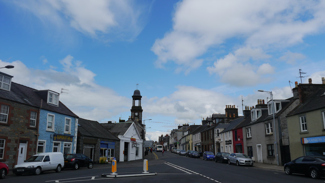
King Street, Castle Douglas
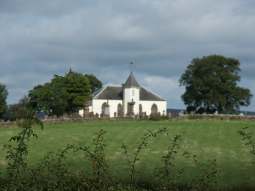
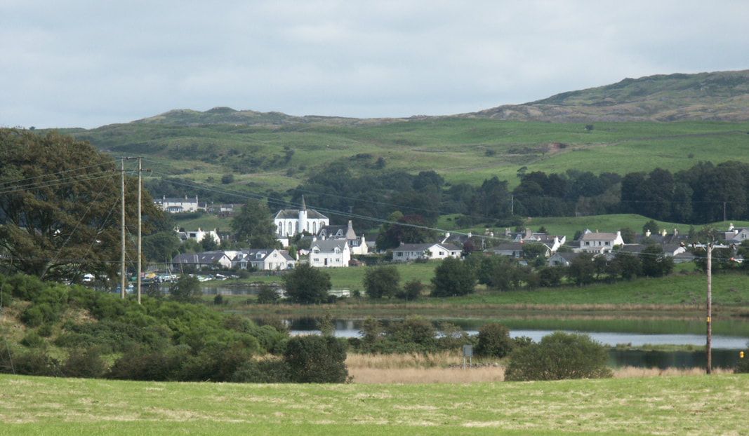
Balmaghie Parish Church, Loch Ken
|
The area was inhabited in pre-historic times - lochs in the area are peppered with crannogs, and Carlingwark Loch has at least 10 islands, many of which are believed to be artificial. Fir island is natural, but was fortified and once possibly housed a smithy.
The Carlingwark Hoard is a collection of items found in the Carlingwark Loch, now housed in the National Museum of Scotland. Another settlement next to the mouth of Carlingwark Lane Canal called The Buchan was developed for the marl trade before Castle Douglas was built. The railway came to the area in 1859, with the opening of the Castle Douglas and Dumfries Railway, which was routed via Dalbeattie. In 1861 the Portpatrick Railway extended the railway to the west; and the Kircudbright Branch was addded in 1864, which initially ran to a separate temporary station in St Andrew Street. Castle Douglas Station was built a few hundred yards north of the town - though development soon extended to and past the station. Since closure of all the railways in 1965, the station site is now a Tesco supermarket. A major livestock market was established in the town in 1900 next to the station. Castle Douglas is now called Scotland's Food Town "with multiple independently owned traditional butchers, bakers, grocers and delis, alongside skilled chocolatiers, craft brewers and a lovely selection of welcoming cafes and restaurants serving a wide range of tasty local produce." Arriving & DepartingOpen Cycle Map Bing Map
Castle Douglas is on National Cycle Route 7. The nearest Station is Dumfries (DMF) (17 miles) - Live train times. SleepingCrown Hotel 25-26 King Street 01556 502231
Kings Arms Hotel 31-33 St Andrew Street 01556 502626 Market Inn Hotel 7 Queen Street 01556 505070 Imperial Hotel 35 King Street 01556 502086 Urr Valley Hotel Ernespie Road 01556 502188 Summerhill B&B Abercromby Place 01556 502658 Douglas House B&B 63 Queen Street 01556 503262 The Station Hotel where I spent a night in 2002 is no longer a hotel. Douglas Arms Hotel is currently closed For more CastleDouglas.com or Castle Douglas Food Town 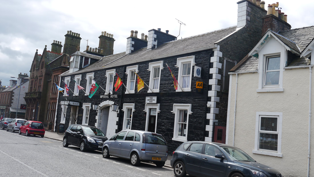
Imperial Hotel
EatingCrown Hotel 25-26 King Street 01556 502231
Kings Arms Hotel 31-33 St Andrew Street 01556 502626 Market Inn Hotel 7 Queen Street 01556 505070 Imperial Hotel 35 King Street 01556 502086 Urr Valley Hotel Ernespie Road 01556 502188 Jewel in the Crown Ernespie Road 01556 505999 (Indian) Nikos Greek Restaurant 139 King Street 01556 504345 Mr Pook's Kitchen The Old Bank, 38 King Street Opening Spring 2018 For more CastleDouglas.com or Castle Douglas Food Town DrinkingSulwath Brewery Tap 209 King Street 01556 504525 RA
Crown Hotel 25-26 King Street 01556 502231 Kings Arms Hotel 31-33 St Andrew Street 01556 502626 Market Inn Hotel 7 Queen Street 01556 505070 Imperial Hotel 35 King Street 01556 502086 MW Urr Valley Hotel Ernespie Road 01556 502188 For more CastleDouglas.com or Castle Douglas Food Town CyclingCastle Douglas Cycles Church Street 01556 504542
Studio Velo 26-30 St Andrews Street 01556 503069 Dalbeattie - 7 miles MPG Cycles 1 Milo Place Garage, High Street 01556 610659 Bikes can also be hired from Gorsebank Glamping Greenhill Farm 01556 610174/07791 853402
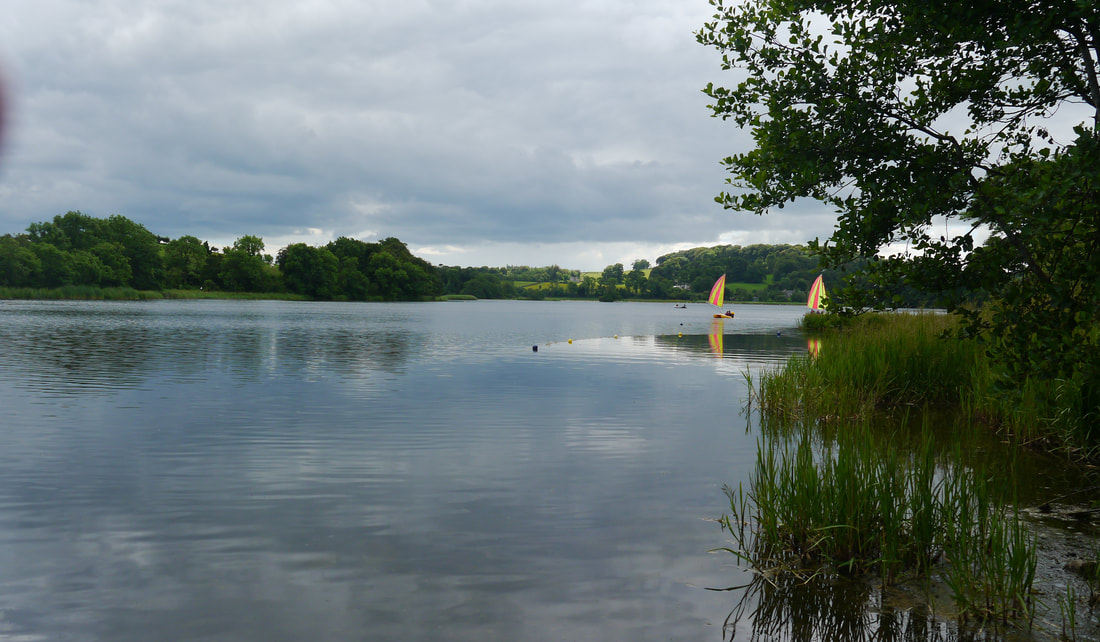
Carlingwark Loch
Carlingwark Loch
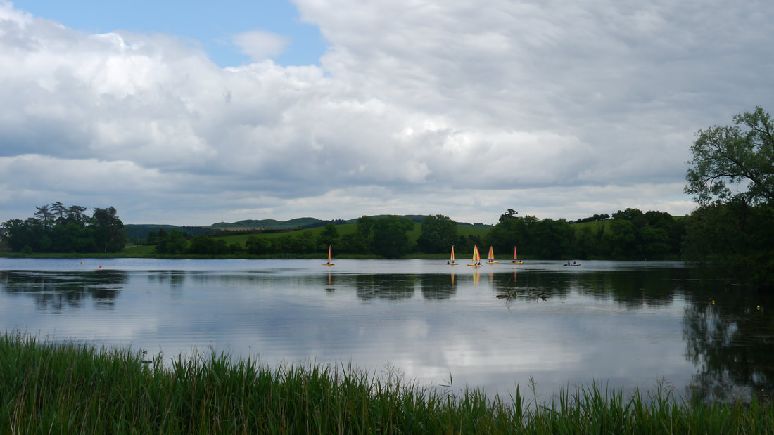
Crossmichael, Loch Ken
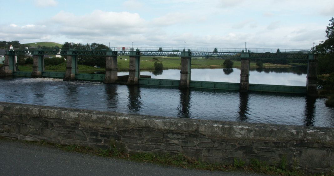
Loch Ken Barrage
Finding The JarknessTrying to find out something about this intriguing name is complicated by RIg of the Jarkness being a track by Frog Pocket, "the recording name of John Charles Wilson a Scottish Musician", from Ayr, whose website's news ends with an entry detailing a forthcoming gig at Gatehouse of Fleet on 26th May 2016. Jarkness is also a character in League of Legends, a "multiplayer online battle arena video game"
Most sites mentioning the original Rig of the Jarkness are concerned with walkers/climbers, who observe the oddness of the name, but have never found out why. Jark is a gum from a species of Acacia that was used by indigenous Australians, which is at least more promising than Jark Matter being "an evil organisation that has taken over the galaxy" in a Japanese live action drama; or that Jark is a rural Persian village; an old alternative name for the Rianila River in Madagascar. Finally, an archived Forestry Commission Booklet of Forest Parks, published in 1969 costing 3s 6d! "All around stand the great hills, with romantic names derived from the Gaelic or Norse tongues now vanished from the Galloway scene. Benyellary, Mullwharchar, and the Rig o’ the Jarkness are examples." I have also found an interesting picture of the area on Wikipedia page about Galloway Hills. Its name is spelt the same on the first OS map. |

Photos on this page were taken by me. Click on photo to enlarge. Full size versions and my other pictures are available on Flickr at:
Castle Douglas: https://www.flickr.com/photos/martynjenkins/sets/72157689625198601
Loch Ken: https://www.flickr.com/photos/martynjenkins/sets/72157690415636184
Castle Douglas: https://www.flickr.com/photos/martynjenkins/sets/72157689625198601
Loch Ken: https://www.flickr.com/photos/martynjenkins/sets/72157690415636184
